

Revolutionizing Mineral Exploration with Remote Sensing

As high-quality mineral deposits in developed regions continue to dwindle, mining companies are being forced to explore increasingly remote locations. Traditional methods of mineral exploration, while effective, are expensive, time-consuming, and often harmful to the environment. In contrast, remote sensing technology is proving to be a game-changer, allowing mining companies to identify valuable resources efficiently while minimizing ecological impact.

Modern remote sensing methods, such as hyperspectral imaging and LiDAR mapping, provide highly detailed geological data that enhances exploration accuracy. The integration of geospatial artificial intelligence (Geo AI) and satellite-based monitoring has further revolutionized how mining companies locate and extract resources. With advancements in AI-powered data analysis, real-time satellite imaging, and machine learning algorithms, remote sensing is ushering in a new era of sustainable mining.
Related News
- EU Warns of Counterstrike as U.S. Tariffs Push Steel Prices Higher
- Atlas Copco’s Electric Compressors Power Portugal’s Marble Industry
- Ukraine and the U.S. Partner in the Critical Minerals Sector
- Canada’s Mining Industry Warns: Critical Mineral Stockpiles Useless Without Processing Infrastructure
The Evolution of Remote Sensing in the Mining Industry
Remote sensing has played a crucial role in mineral exploration for decades. In its early stages, aerial photography was the primary tool used to identify geological formations that signaled the presence of mineral deposits. While effective, this method lacked precision and required extensive fieldwork for verification.
Today, advancements in remote sensing technology have significantly improved the accuracy and efficiency of mineral exploration. High-resolution satellite imagery, hyperspectral imaging, and LiDAR technology now provide mining companies with precise data about the Earth’s surface and subsurface. These innovations have reduced the need for invasive fieldwork, lowering costs and minimizing environmental disruption. As a result, remote sensing has become an essential tool in modern mining, enabling companies to identify potential mineral-rich areas with unprecedented accuracy.
How Remote Sensing is Enhancing Mining Operations
The mining industry has increasingly embraced remote sensing to detect, map, and monitor mineral deposits. One of the most promising technologies in this field is hyperspectral imaging, which captures electromagnetic radiation reflected from minerals. By analyzing these spectral signatures, geologists can identify specific mineral compositions without the need for extensive ground surveys. This technology has proven particularly valuable in locating rare earth elements and precious metals, which are often difficult to detect using traditional exploration methods.
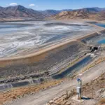
Another groundbreaking innovation is Light Detection and Ranging (LiDAR), which uses laser pulses to generate highly detailed 3D topographic maps. By revealing subtle geological features, LiDAR helps mining companies pinpoint potential mineral deposits while also assessing terrain stability. This is especially important in open-pit mining, where slope stability is a major safety concern.

Radar imaging has also become a key tool in mineral exploration, providing high-resolution geological maps regardless of weather conditions or time of day. Unlike traditional aerial photography, radar can penetrate cloud cover and deliver real-time data, making it an invaluable asset for exploration in remote or harsh environments. Additionally, thermal imaging has gained popularity in mining operations, as it detects heat signatures associated with mineral deposits and geothermal activity. This method has been particularly useful in identifying underground mineral veins and locating potential drilling sites.
The Role of Remote Sensing in Sustainable Mining
Sustainability has become a top priority for the mining industry, and remote sensing is playing a crucial role in promoting environmentally responsible practices. One of its most significant contributions is in reducing the need for extensive field surveys, which often involve deforestation, land disruption, and resource-intensive excavation. By using satellite-based remote sensing, mining companies can efficiently locate mineral deposits without disturbing the ecosystem.
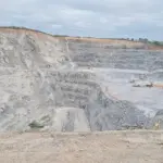
In addition to exploration, remote sensing is also enhancing mine safety. Radar imaging is being used to monitor slope stability in open-pit mines, helping prevent landslides and ensuring the safety of workers and equipment. Similarly, LiDAR technology is being applied to monitor water resources in mining areas, tracking water seepage, evaporation, and distribution to prevent contamination and comply with environmental regulations.
Another important application is in detecting toxic gas emissions, which pose a serious environmental and health hazard. Infrared imaging enables mining companies to identify leaks of harmful gases such as sulfur dioxide and fluoride, allowing them to take preventive measures before pollution spreads to surrounding ecosystems. Additionally, multispectral imaging is being used to assess groundwater pollution by detecting changes in vegetation health, which often indicate contamination. These insights are crucial for implementing effective remediation strategies and maintaining compliance with environmental standards.
AI and Satellite-Based Remote Sensing: The Future of Mining Exploration
The integration of artificial intelligence with remote sensing is taking mining exploration to the next level. One of the most promising innovations in this field is Geospatial Artificial Intelligence (Geo AI), which combines machine learning algorithms with satellite and aerial imagery. By analyzing vast datasets, Geo AI can detect subtle geological patterns that may indicate the presence of valuable minerals. This level of precision allows mining companies to focus their efforts on high-potential areas, reducing the need for exploratory drilling and minimizing environmental impact.
Despite its potential, Geo AI faces challenges, including the need for large training datasets and the complexity of integrating information from multiple sources. However, as machine learning models continue to improve and access to high-resolution satellite imagery increases, Geo AI is expected to become a cornerstone of mining exploration.
One initiative that is pushing the boundaries of AI-driven remote sensing is the GoldenEye Project, backed by the European Commission. This ambitious program is developing an advanced remote sensing platform that combines satellite imagery, drone surveillance, and ground-based sensors. By leveraging AI-powered data analysis, the project aims to make mineral exploration more cost-effective, accurate, and environmentally sustainable. If successful, GoldenEye could serve as a model for the future of remote sensing in the mining industry.
The Future of Remote Sensing in Mining
As technology continues to advance, remote sensing is set to become an even more integral part of mining operations. The ability to collect real-time, high-resolution geological data is not only improving exploration accuracy but also enhancing mine safety and sustainability. By reducing reliance on traditional, invasive exploration methods, remote sensing is helping mining companies minimize their environmental footprint while maintaining profitability.
The future of remote sensing in mining will be shaped by ongoing developments in AI, real-time satellite monitoring, and advanced imaging techniques. Companies that invest in these technologies will not only gain a competitive edge but also set new industry standards for responsible resource extraction. As regulatory pressures and environmental concerns continue to grow, remote sensing will remain at the forefront of sustainable mining practices, ensuring that mineral exploration aligns with global conservation efforts.